Walking is so popular that there is a small industry around creating ideas for walks so there are lots of guides you can find for local walking routes. If you are not familiar with an area, or are not particularly good at reading maps, finding a good walk is hard. Our leaders use their experience, walk books and some exploration to come up with enjoyable and safe walks.
We recommend the OS Maps application and within that you can find some walks but as these are generally just lines on maps, it isn’t easy to tell if it is a good walk.
Local Walks
One of our members wrote some local starter walks, designed to be easy follow, for people who were unfamiliar to rambling. They were published on the Dorridge & Residents Association website.
They are old walking guides with handy pictures but generally the walks haven’t changed, but bear in mind they were written nearly 20 years ago.
Here are scans of out of print walk books that Solihull Council provided.
Rambler’s Library
We have a library of physical books that can be borrowed by members.
KNOWLE RAMBLERS’ WALK GUIDES
20 Walks in Shipston Country – Macmillan Way Association
Heart of England Walks -Pathfinder Guide
Coventry Way Circular Walks – Coventry Way Association
Kenilworth and Beyond – Kenilworth Footpath Preservation Group
The Heart of England Way – The Heart of England Association
Best walks in the Peak District – A Constable Guide
12 Country Walks in Solihull
12 more Country Walks in Solihull
Ridges and Valleys Walks in the Midlands
Family Walks in the Midlands
50 Walks in Warwickshire and West Midlands AA
Rambling Around the Midlands – Birmingham Post and Mail
Let’s Walk There – Central England
Cross the Stile – Walks around Harbury
Kingsbury Water Park Walking and Cycling
Shakespeare Country, Vale of Evesham and the Cotswolds Pathfinder Guide
Shropshire, Staffordshire, and the Heart of England Pathfinder Guide
50 Walks in Hereford and Worcestershire AA
Family Walks in Warwickshire
Solihull Park Walks (they are all short walks 2 miles or less)
Walks around Packwood House and Baddesley Clinton
Further Afield
The Peddlers Way and Norfolk Coast
West Dorset and East Devon
Winchester
Keswick
North Pembrokeshire
50 Great British Walks – The Daily Telegraph Parts 1 and 2
Llangollen
Church Stretton
Walks around Bishops Waltham (Hampshire)
Barmouth
Dolgellau
Cheviot Hills
Gants Guide to Hay on Wye
Other Books
Follow the Map – the Ordnance Survey Guide
Historic Pubs and Inns of Warwickshire
AA Walks

The AA has sold walk books for many years. They have lots of walks around the country but they tend to have very concise route descriptions so mapping out their instructions is recommended. They have made their collection available online and are searchable.
Maps
Comparison
Google Maps is great for cars but is very limited for walking. At the time of writing it does not have footpaths in it so it can’t help if you can’t locate a path.
OS Maps has a free version which uses the open source Open Street Map data to show a free view which does have footpaths. The paid version provides OS Maps for the whole of the UK, and also if you have a recent OS Map for an area, you can add that in and use it in the app without a subscription by using a code that comes with it.
Many walk books have maps in, but it is very variable. Some are excellent with OS maps, others are hand drawn approximations that need interpretation with the text.
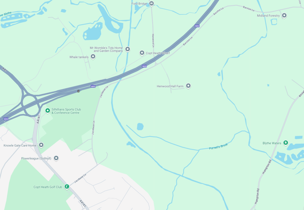
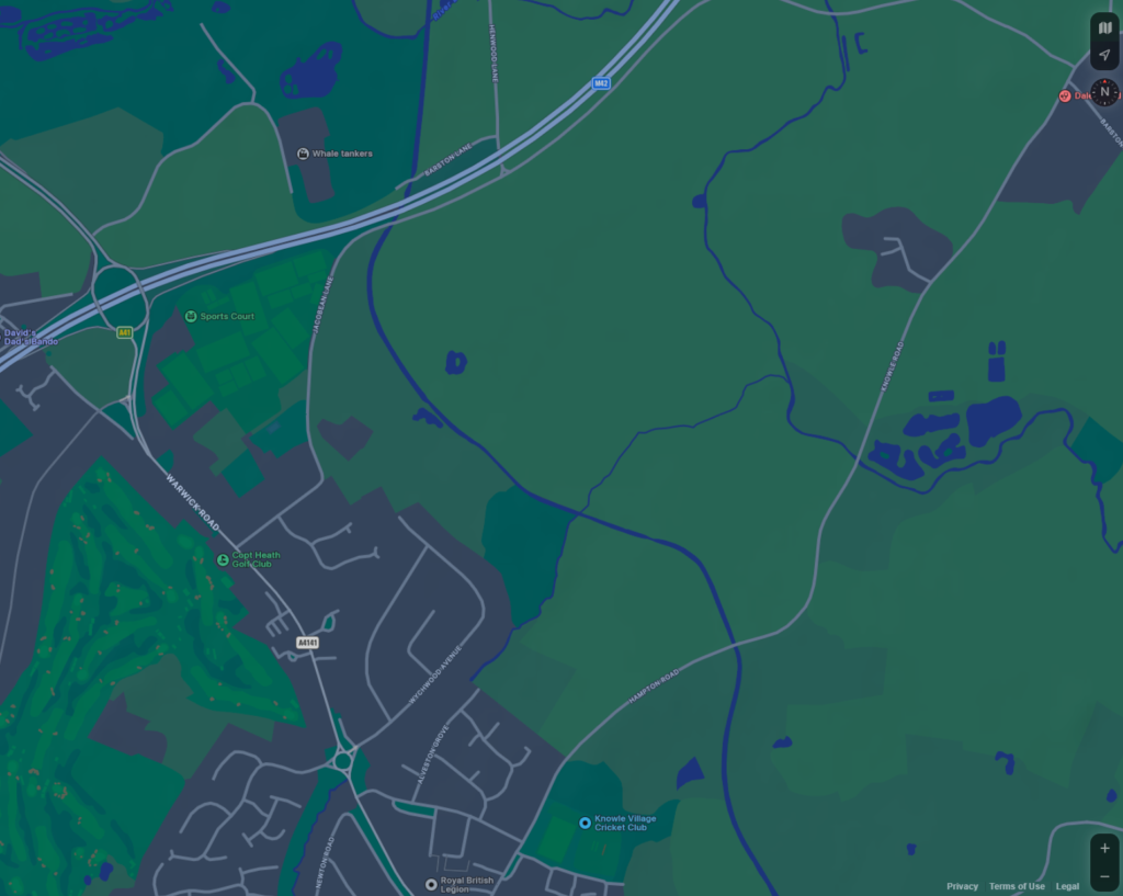
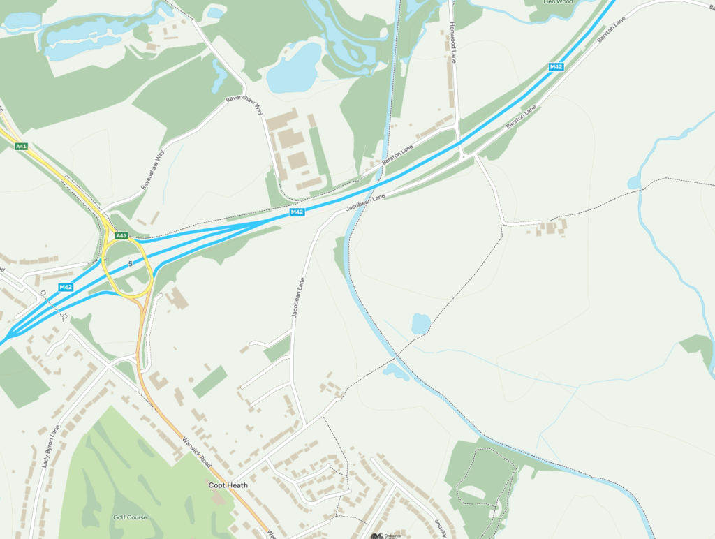
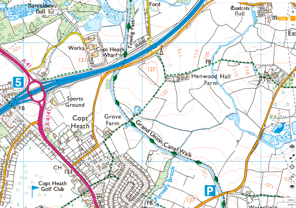
Plotting Routes
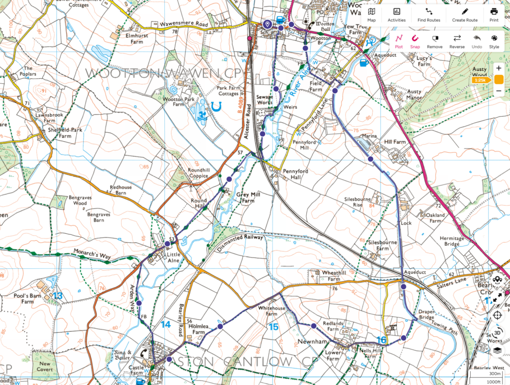
OS Maps has easy ways of plotting routes, and if you have the application you can use it on a PC/Mac as well (no extra charge). Using a PC to edit routes is easier as it allows amendments. It is often easier to follow the route from the map than trying to work out cryptic instructions from a walk guide.
Maps on Smart Phones
The main thing to remember is that without a data signal, your phone can’t get a map. To be certain of having a map available, with OS Maps you can download a map before you leave home and so it does not need a signal to show the map, and the GPS your phone uses to show where you are. Phones does not need a phone signal to locate you. Of course, flat batteries don’t help, and using mapping will tend to use a bit more battery, but modern phones have no issue with using maps, recording walks, fitness tracking and all that kind of thing for walking all day as long as you charge up.
Perhaps the most useful thing is when you know that there is a footpath close by and you can’t see it. Having the phone map which will show your position within a few feet is often enough to help find an overgrown stile or one just hidden behind a wall. Also, it is helpful for walking across fields without a marked footpath as you can tell which direction you should be walking in fairly accurately if you can’t spot the landmark at the other side – this especially useful if the footpath is through crops and you want to make sure you are not causing unnecessary damage.

